Evaluating the movement of free-roaming dogs using georeferencing and the photographic capture-recapture method
DOI:
https://doi.org/10.21708/avb.2019.13.2.7779Resumen
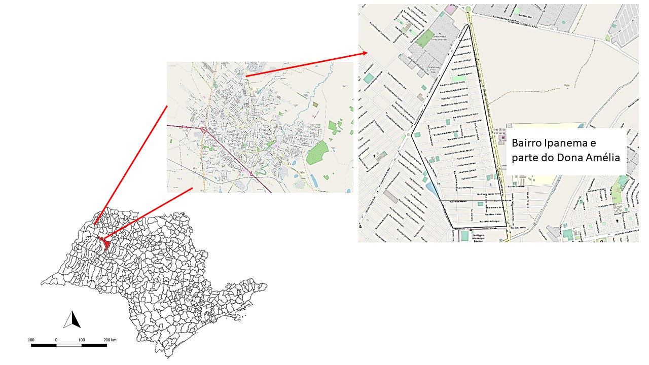
This work proposes to use the photographic capture-recapture technique associated with the GPS positioning (Global Positioning System) to estimate the population and to evaluate the movement of free-roaming dogs in public spaces. An observer on a motorcycle traveled all the streets of Jardim Ipanema and part of Dona Amelia neighborhoods in Araçatuba, SP, totaling a 1.3 Km2 area covered on two days, with a one-week interval between them. The free-roaming dogs were photographed and their geographical locations were determined using GPS, and this geographic record was then used to estimate the spatial and temporal distribution of free-roaming dogs in the neighborhood. A total of 77 dogs were found on the streets, 21 of which were photographed more than once (photo-recaptured). The number of free-roaming dogs was estimated from the capture rate using a linear regression model, revealing a population of 76 animals, corresponding to 7.5% of the canine population living in the neighborhood. The results indicated a higher concentration of free-roaming dogs in a certain neighborhood region that has unpaved streets and most houses had no walls. Furthermore, the highest number of dogs was observed early in the day (between 7 and 9 a.m.) and that, among the dogs observed moving through the neighborhood streets, the longest distance traveled was 520m. It is concluded that the proposed methodology is an efficient tool and can be used when planning public health activities.
Descargas

Descargas
Publicado
Número
Sección
Licencia
Autores que publicam na Acta Veterinaria Brasilica concordam com os seguintes termos: a) Autores mantém os direitos autorais e concedem à revista o direito de primeira publicação, com o trabalho simultaneamente licenciado sob a Licença Creative Commons Attribution que permite o compartilhamento do trabalho com reconhecimento da autoria e publicação inicial nesta revista. b) Autores têm autorização para assumir contratos adicionais separadamente, para distribuição não-exclusiva da versão do trabalho publicada nesta revista (ex.: publicar em repositório institucional ou como capítulo de livro), com reconhecimento de autoria e publicação inicial nesta revista. c) Autores têm permissão e são estimulados a publicar e distribuir seu trabalho online (ex.: em repositórios institucionais ou na sua página pessoal) a qualquer ponto antes ou durante o processo editorial, já que isso pode gerar alterações produtivas, bem como aumentar o impacto e a citação do trabalho publicado (Veja O Efeito do Acesso Livre).


 Esta obra está licenciada com uma Licença